
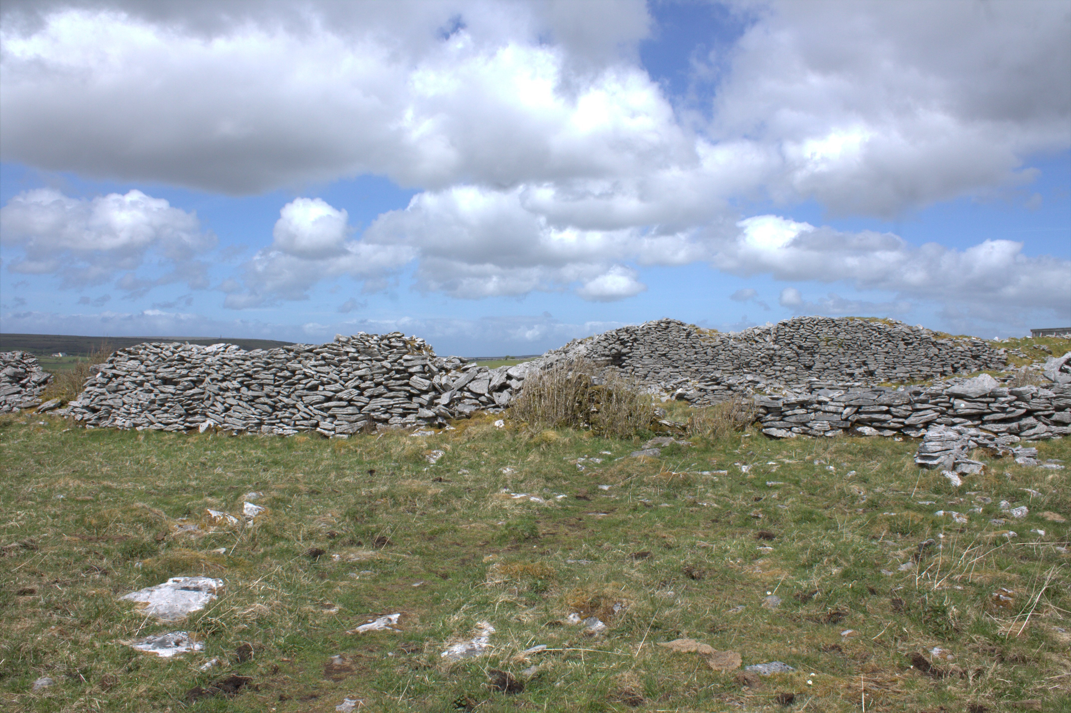
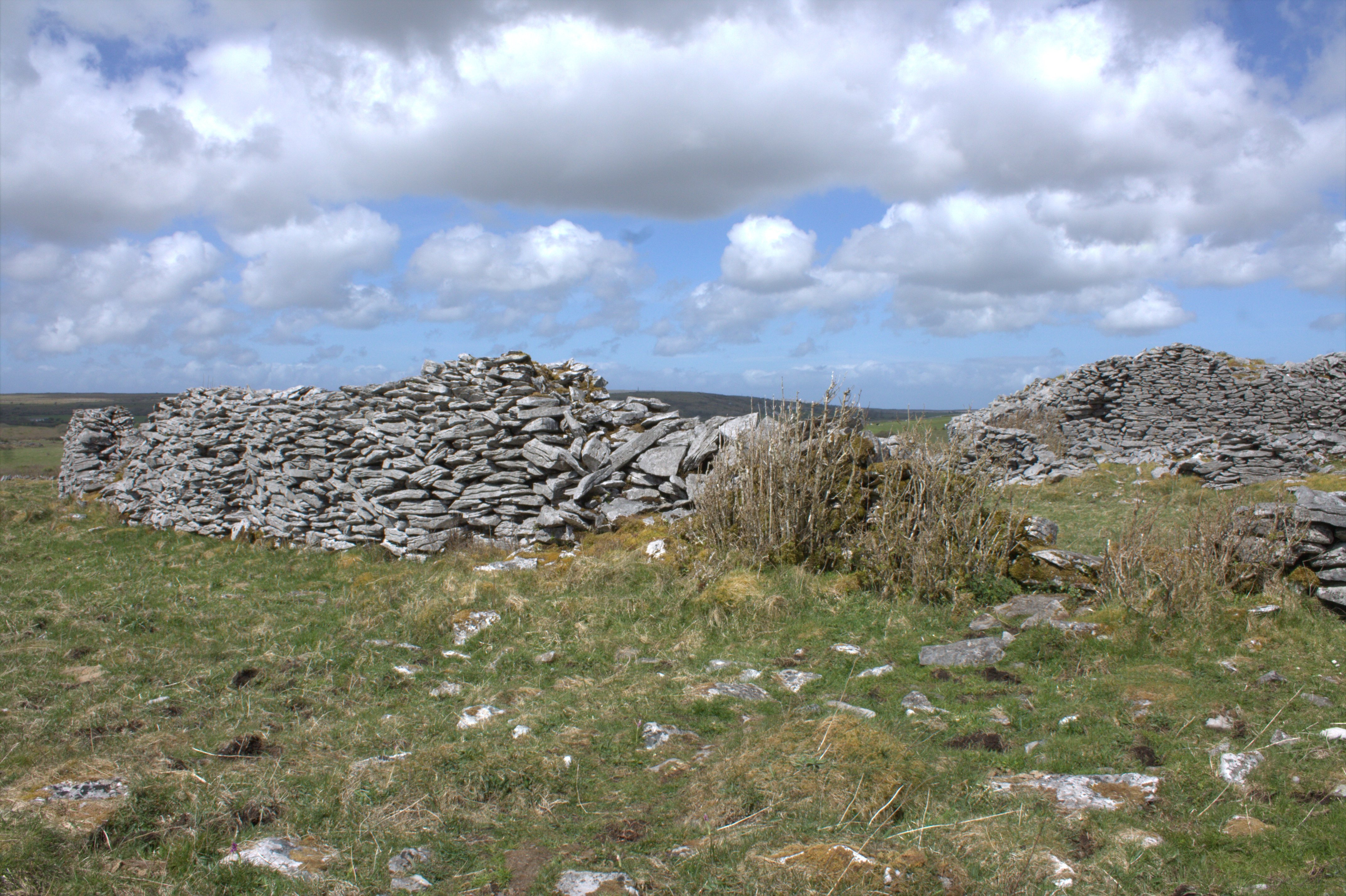

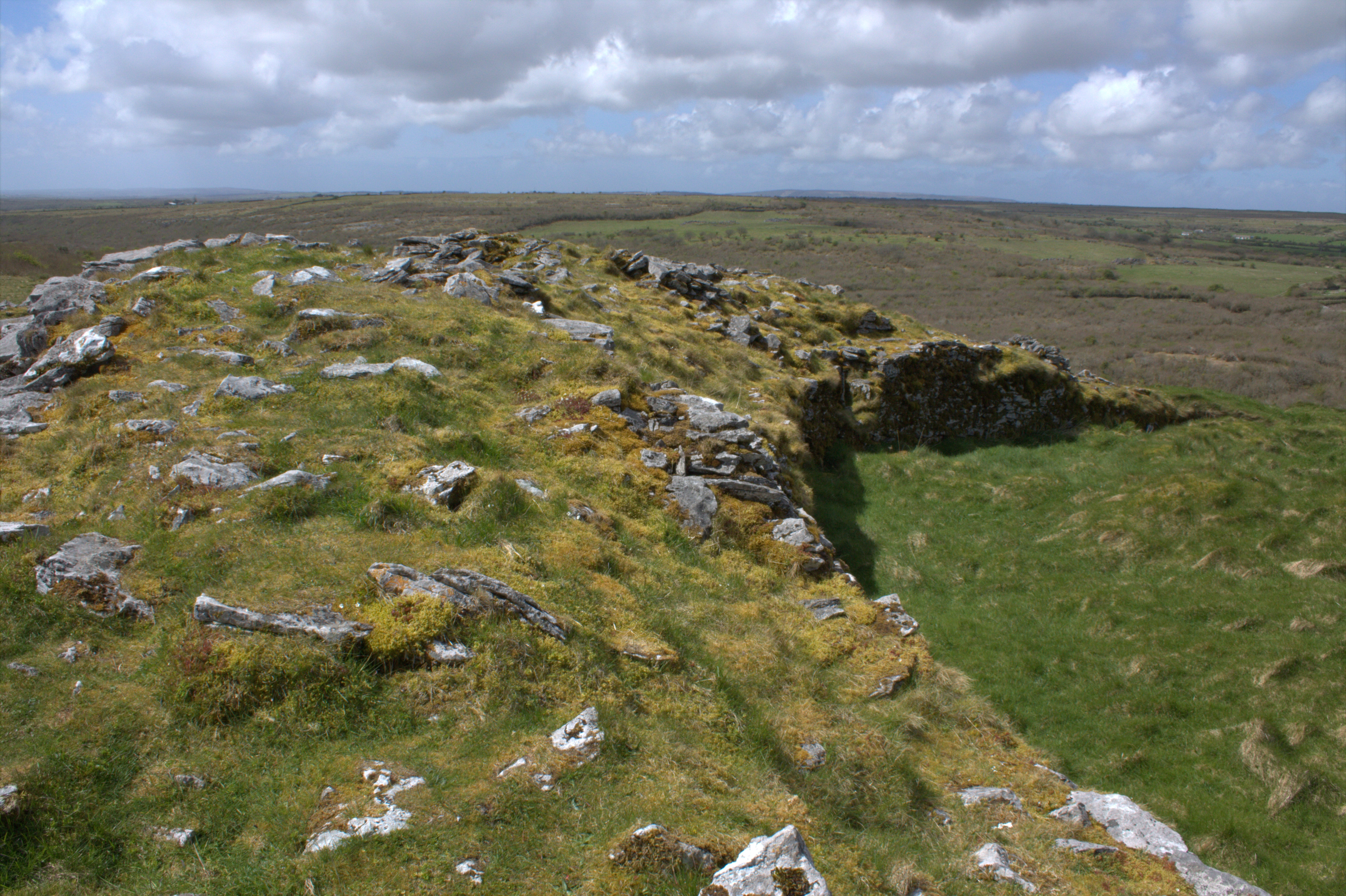


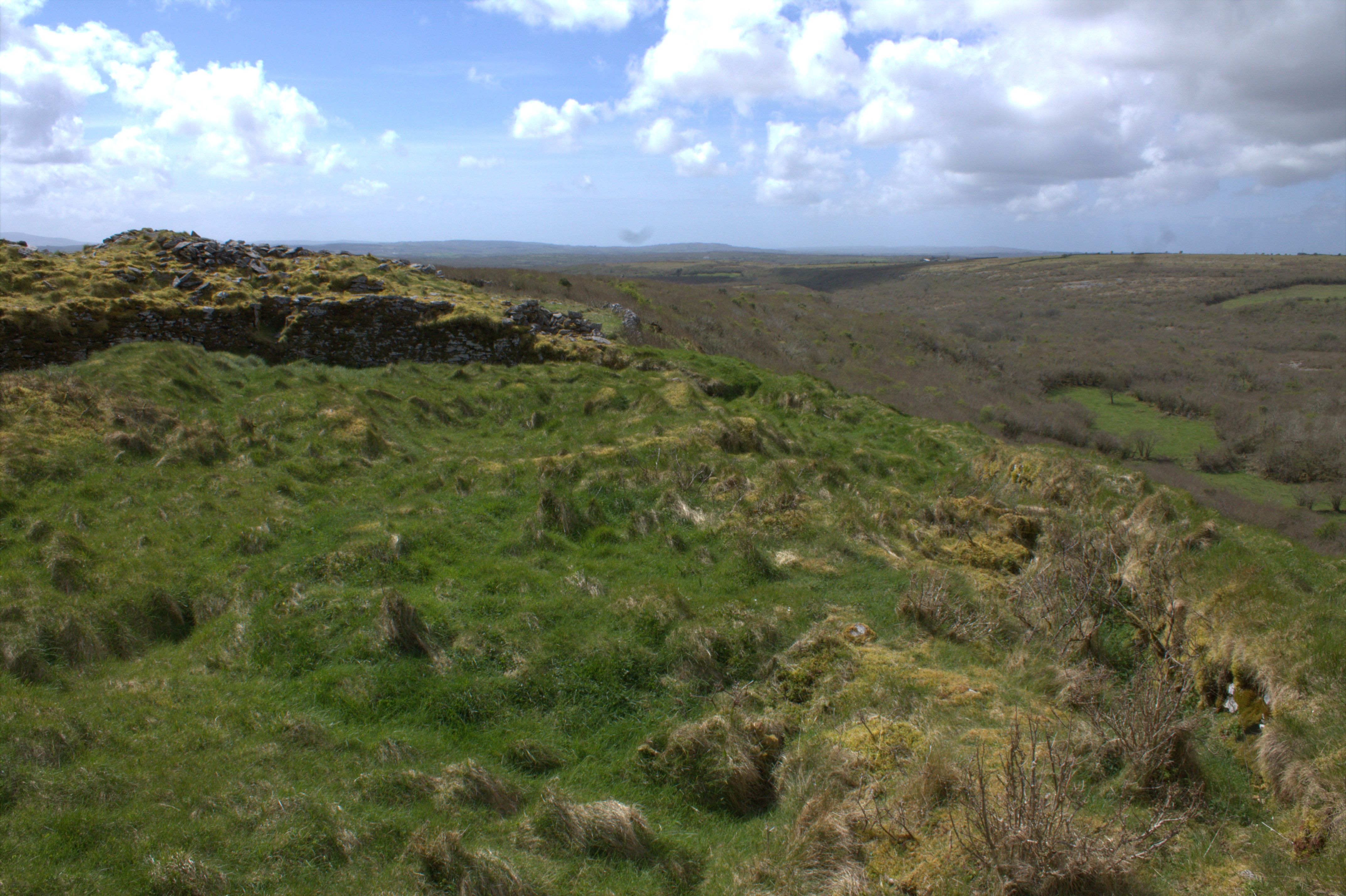


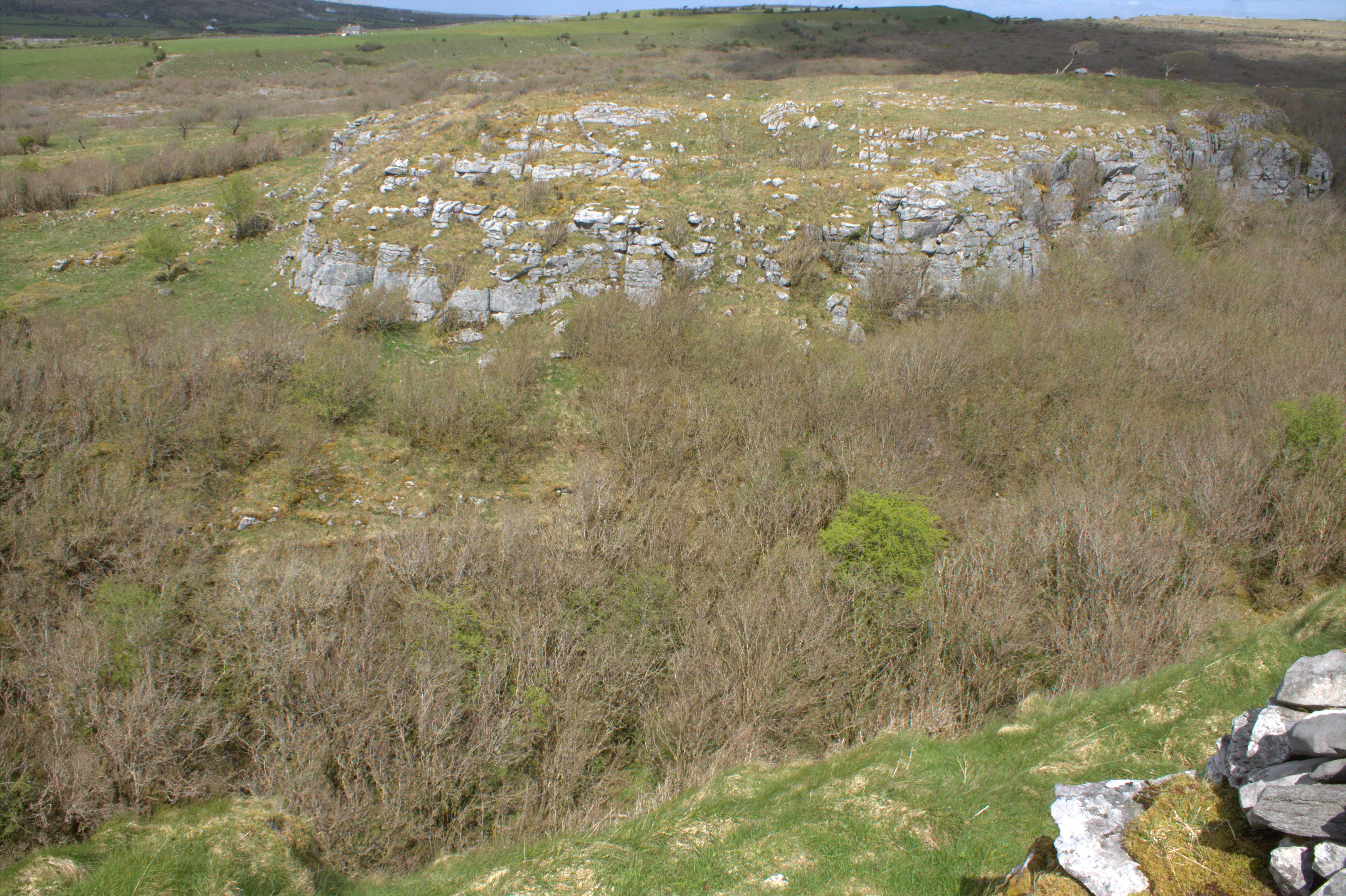


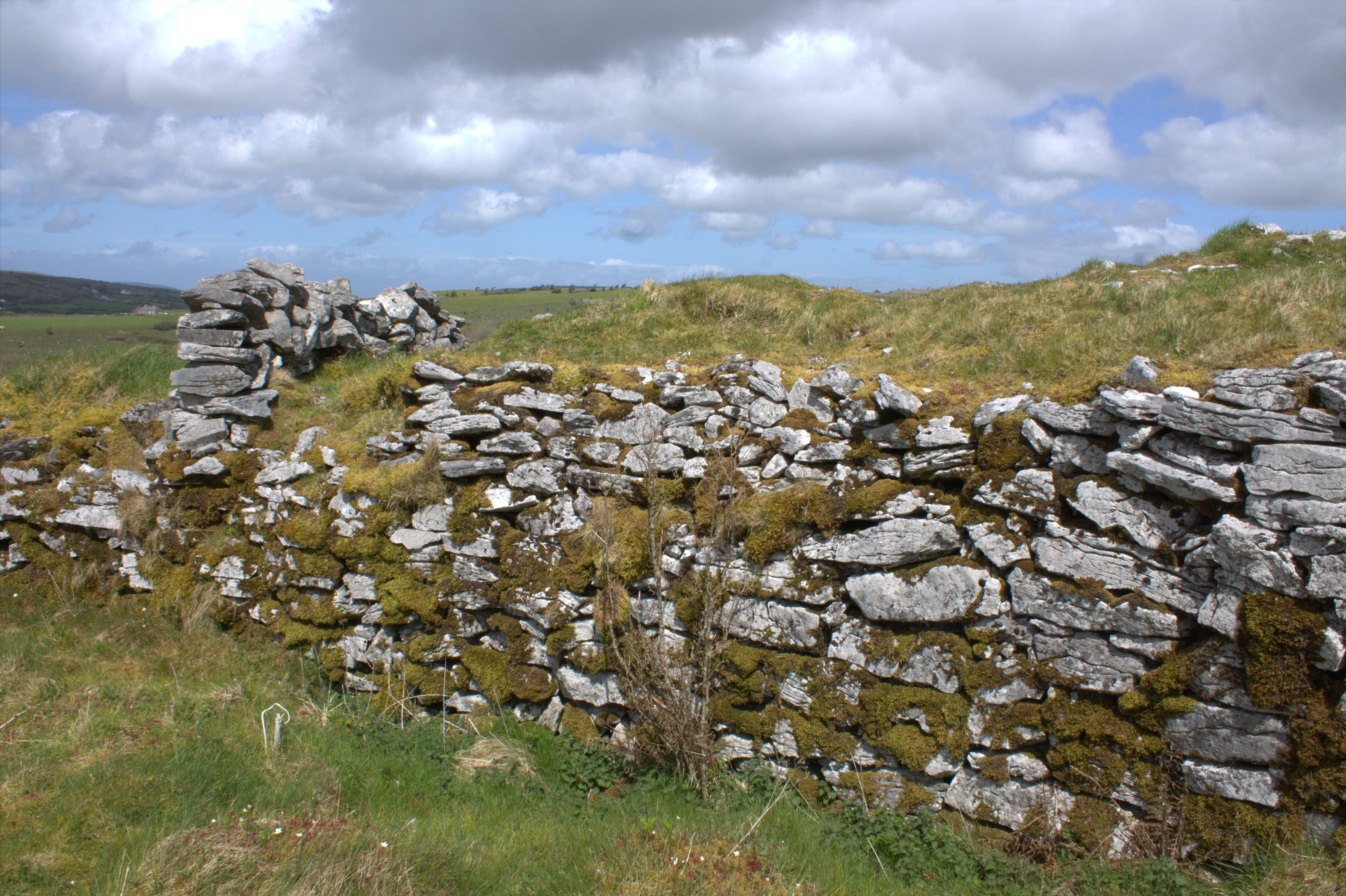


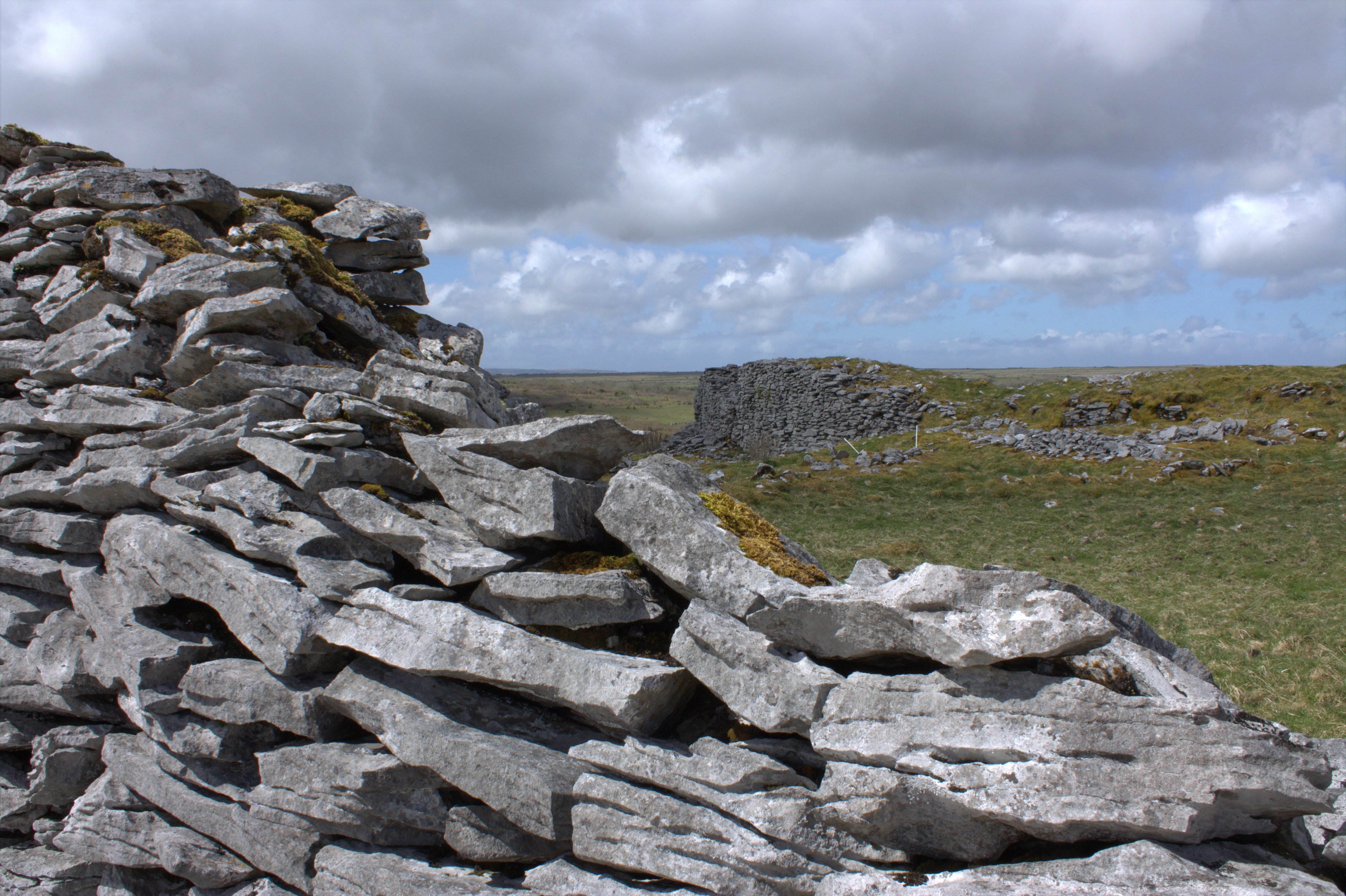

Cahercommaun Stone Fort is an inland Cliff Fort, similar to Dún Aonghasa on Inishmore but far more ruinous. The stone fort dates from around the 9th century as evidenced by a silver broach found in one of the fort’s souterrains, however a settlement did exist at this site from as early as the 5th century. Cahercommaun has a breathtaking backdrop, situated on the north western edge of the plateau of Glaseivagh Hill, with a drop of 30 metres on its north most side. Three concentric stone walls surround the inner most dwellings and these are immense in size, the inner wall alone used 16,500 tons of stone and is about 3 metres in thickness. The outermost wall measures over 100 metres east-west and 75 metres north-south.
Cahercommaun was excavated in 1934 and it was ascertained that at least twelve stone buildings would have been situated within the fort. The community at Cahercommaun would have been home to over 40 people. A series of souterrains run under the fort, one apparently leading all the way to the cliff face. A saddle quern, wooden spindles for weaving, jewellery and a padlock were just some of the items found during excavations.
Its a 1km walk from the main road to Cahercommaun but I thoroughly recommend paying it a visit, my photos don’t do it justice and obviously the best view of it would be from the air but it was certainly a intriguing site to see.
GPS: 53.01458, -9.0705